
Need to See Below the Canopy?
Partner with GeoCue to Give Your Customers Proven Drone LiDAR Solutions
Help your customers see beyond the surface with proven LiDAR hardware, LP360 software, and expert support, all from one provider. GeoCue helps drone manufacturers offer complete LiDAR solutions for mapping applications by combining a full portfolio of TrueView sensors, LP360 processing software, and expert in-house support to make LiDAR easier to integrate, easier to sell, and easier for customers to use successfully.
Benefits of Partnering with GeoCue:
Intrested in learning more?
Please fill out this form
Our Supported Drone Platforms


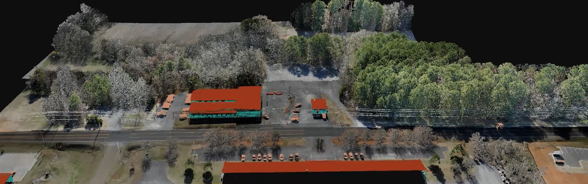
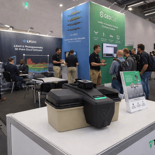
Take advantage of the full TrueView Aerial LiDAR Portfolio
GeoCue can support a wide range of aerial LiDAR opportunities.

Complete Offering
A full workflow, not just a sensor
Bundle trusted LiDAR sensors with LP360 software that takes users from raw data to colorized point clouds and deliverables inside one environment.

Partner Enablement
Commercial Support to help you sell effectively
Leverage product positioning, demo support, launch collaboration, and technical guidance to move faster with new integrations and joint opportunities.

Scalable Portfolio
Solutions for different mission profiles
Match customers to the right combination of payloads, software, and budget rather than forcing a one-size-fits-all approach.
We Value Drone Manufacturers as True Partners
GeoCue works with drone manufacturers as long-term partners, not just platform providers. Many relationships grow into reseller opportunities, joint marketing programs, co-branded campaigns, and special customer projects.
Our R&D team can work closely with your technical team to support integration, customization, and platform-specific requirements. We specialize in building compatible solutions that bring the drone, LiDAR payload, software workflow, and final deliverables together.
Commercial and technical alignment
Partnership opportunities include:
A Competitive Portfolio for Every LiDAR Opportunity
The drone LiDAR market is evolving quickly, and customers are comparing more options than ever. GeoCue helps drone manufacturers stay competitive with a full portfolio of TrueView LiDAR sensors for different applications, performance needs, and budgets.
From cost-effective entry-level systems to high-end engineering-grade sensors, GeoCue helps you offer the right solution for the customer, the project, and the price point.
The Right Aerial LiDAR Solution for the Job
GeoCue's aerial LiDAR offers support for a wide range of sensors across platforms, payload classes, and applications. From flexible sensor options to integrated software workflows, GeoCue helps manufacturers deliver scalable, reliable mapping solutions backed by proven geospatial expertise.
NDAA Option
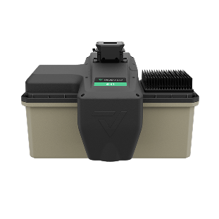
TrueView 641
A strong option for customers seeking an engineering grade aerial LiDAR solution paired with GeoCue software and support.
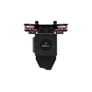
Higher Performance
TrueView 600 Series and High-End Systems
For customers who need greater performance, GeoCue offers higher capability aerial systems that extend the value of your platform.
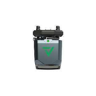
Portfolio Value
Entry to advanced solutions
GeoCue offers a full line-up from entry level to engineering grade aerial lidar sensors giving your customers the right tool, software, training, support, and workflow to get the job done.

Western Component Options for a Changing LiDAR Market
As more European drone manufacturers serve government, infrastructure, public safety, and enterprise customers, component origin and supply chain confidence are becoming more important. GeoCue continues to advance NDAA-compliant LiDAR technology, giving drone manufacturers trusted Western component options without parts sourced from China.
With GeoCue TrueView systems, you can offer high-performance LiDAR solutions designed for today's evolving security and procurement expectations.
Benefits for your customers:
LP360: The Complete Workflow Advantage
With GeoCue, your customers get more than a LiDAR sensor. They get a complete hardware and software ecosystem built to take projects from field collection to final deliverable.
LP360 gives users the tools to process, clean, classify, colorize, validate, and deliver LiDAR data in one connected workflow. Instead of relying on separate software providers or disconnected processes, your customers can work within the GeoCue ecosystem from start to finish.
How the partner conversation can flow
A simple structure for qualifying fit, identifying the right payload path, and building a complete go to market story.

Define fit
Review platform compatibility, target markets, and where GeoCue adds the most value to your product portfolio.

Select solution
Match the right LiDAR system and LP360 software path to the applications you want to serve.

Enable the team
Align messaging, demo strategy, and technical knowledge so your team can sell with confidence.

Launch together
Support awareness with co-marketing, partner outreach, and a more complete story for customers.
Ready to explore a GeoCue partnership?
Let's talk about how GeoCue can support your drone platform with LiDAR payload options, LP360 software, and partner support that helps create a stronger end to end solution.